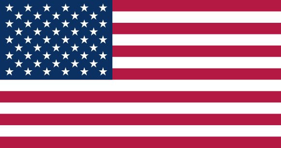
Administrative divisions of United States
The United States is divided into 51 first-level administrative divisions:
Largest cities in United States
| # | City | Population |
|---|---|---|
| 1 | New York | 19,040,000 |
| 2 | Los Angeles | 12,500,000 |
| 3 | Chicago | 8,990,000 |
| 4 | Miami | 5,585,000 |
| 5 | Philadelphia | 5,492,000 |
| 6 | Dallas | 4,798,000 |
| 7 | Atlanta | 4,506,000 |
| 8 | Boston | 4,467,000 |
| 9 | Houston | 4,459,000 |
| 10 | Washington, D.C.Capital | 4,338,000 |
New York is the largest urban area in the United States with about 19,040,000 people; the capital, Washington, D.C., has about 4,338,000.
Terrain, rivers & lakes
Highest terrain in the United States: ≈ 5,884 m — read from the global elevation model, so summit heights are approximate. The physical map paints elevation bands from green lowlands to brown highlands.
🌊 Rivers
- Sagavanirktok
- Meade
- S. Fork Kuskokwim
- Snake
- Columbia
- Rio Grande
- Rio Batepito
- Kennebec
- Arkansas
- Mississippi
- Stikine
- Colorado
- Sacramento
- Tennessee
- Klamath
- Holston
- Sprague
- Salinas
- Kuskokwim
- N. Fork Kuskokwim
- Copper
- Susitna
- Tanana
- Porcupine
- St. Lawrence
- Koyukuk
- San Joaquin
- Chattahoochee
- Alabama
- Tugaloo
- Chattooga
- Savannah
- Rainy
- Winnipeg
- Pit
- Double Mountain Fork Brazos
- S. Branch Potomac
- Hudson
- Wabash
- Saint John
- Yadkin
- Willamette
- Gila
- Brazos
- Trinity
- Great Pee Dee
- Pend Orielle
- Potomac
- Yellowstone
- Wisconsin
- North Platte
- Red
- Green
- Pecos
- Roanoke
- Colville
- Susquehanna
- Prairie Dog Town Fork Red
- Haw
- Connecticut
- Clark Fork
- Pearl
- Oconee
- Yukon
- Rogue
- Eel
- Stanislaus
- Minnesota
- Cape Fear
- Altamaha
- Platte
- Iliamna Lake Outlet
- Feather
- San Juan
- Wind
- Humboldt
- Canadian
- Cheyenne
- Congaree
- Flathead
- Saint Johns
- Bear
- Cooper
- Cumberland
- Sabine
- South Platte
- Monongahela
- Tombigbee
- Kankakee
- James
- Grand
- Salmon
- Kobuk
- New
- Marais des Cygnes
- Des Moines
- John Day
- Namekagon
- St. Croix
- Black
- Scioto
- Suwannee
- Broad
- Cowpasture
- W. Branch Susquehanna
- Delaware
- Merrimack
- Mohawk
- Kentucky
- White
- Kaskaskia
- Cedar
- Madison
- Allegheny
- S. Fork Republican
- Tuscarawas
- Niagara
- St. Clair
- Missouri
- Illinois
- Kanawha
- Osage
- Bighorn
- Fox
- Bayou Lafourche
- Muskingum
- Ohio
- Kansas
- Republican
- Santee
🏞️ Lakes
- Lake Erie
- Lake Ontario
- Lake Saint Clair
- Lake Okeechobee
- Lake of the Woods
- Oneida Lake
- Iliamna Lake
- Lake
- Lake Tahoe
- Lake Winnebago
- Lake Champlain
- Keuka Lake
- Seneca Lake
- Cayuga Lake
- Yellowstone Lake
- Teshekpuk Lake
- Flathead Lake
- Rainy Lake
- Lake Pend Oreille
- Canandaigua Lake
- Owasco Lake
- Skaneateles Lake
- Bear Lake
- Utah Lake
- Leech Lake
- Lake Louise
- Mille Lacs Lake
- Lower Red Lake
- Upper Red Lake
- Lake Winnipesaukee
- Lake George
- Lake Havasu
- Upper Klamath Lake
- Chiputneticook Lakes
- Lake Clark
- Canyon Ferry Lake
- Jackson Lake
- Cass Lake
- Lake Winnibigoshish
- Lake Traverse
- Sebago Lake
- Moosehead Lake
- Lake Kissimmee
- Hebgen Lake
- Lake Walcott
- Lake Granby
- Lake Minchumina
- Lake Apopka
- Lake Istokpoga
- Tetlin Lake
- Chesuncook Lake
- Lake Superior
- Lake Michigan
- Lake Huron
- Whitefish Bay
- Saginaw Bay
- North Channel
- Rye Patch Reservoir
- Lake Mohave
- Lake Mead
- Lake Powell
- Fort Peck Lake
- Lake Sakakawea
- Lake Oahe
- Amistad Reservoir
- Lake Chelan
- Millerton Lake
- Lake Francis Case
- Falcon Lake
- Kentucky Lake
- J. Strom Thurmond Lake
- Shasta Lake
- Wheeler Lake
- Franklin D. Roosevelt Lake
- Caballo Reservoir
- Elephant Butte Reservoir
- Red Bluff Lake
- Brantley Lake
- Lake C.W. McConaughy
- Seminoe Reservoir
- Trinity Lake
- John H. Kerr Reservoir
- Lake Texoma
- Flaming Gorge Reservoir
- American Falls Reservoir
- Petenwell Lake
- Lake Seminole
- Lake Barkley
- Lake Moultrie
- Lake Marion
- Lake Meredith
- Ute Reservoir
- Conchas Lake
- Toledo Bend Reservoir
- Palisades Reservoir
- Glendo Reservoir
- Pathfinder Reservoir
- Lake Oroville
- Boysen Reservoir
- Hartwell Lake
- Lake Sidney Lanier
- Lake Gaston
- Smith Mountain Lake
- Walter F. George Reservoir
- Logan Martin Lake
- Mitchell Lake
- Lake Murray
- Great Salt Lake
- Salton Sea
- Goose Lake
- Pyramid Lake
- Malheur Lake
- Harney Lake
- St. Marys River
Ethnic groups in United States
White 61.6%, Black or African American 12.4%, Asian 6%, Indigenous and Alaska native 1.1%, Native Hawaiian and Other Pacific Islander 0.2%, other 8.4%, two or more races 10.2% (2020 est.)
Regionally, White is the most common ethnic group across most of the 51 divisions, while Asian predominates in 1 division (Hawaii); Black or African American predominates in 1 division (District of Columbia).
Source: CIA World Factbook (2020 est.) · regional dominance compiled by Glostats from censuses and surveys
Religions in United States
Protestant 46.5%, Roman Catholic 20.8%, Jewish 1.9%, Church of Jesus Christ 1.6%, other Christian 0.9%, Muslim 0.9%, Jehovah's Witness 0.8%, Buddhist 0.7%, Hindu 0.7%, other 1.8%, unaffiliated 22.8%, don't know/refused 0.6% (2014 est.)
Regionally, Protestant is the most common religious group across most of the 51 divisions, while Roman Catholic predominates in 6 divisions (Rhode Island, Massachusetts, Connecticut, New Jersey, New York, New Mexico); unaffiliated predominates in 2 divisions (Vermont, New Hampshire); Church of Jesus Christ predominates in 1 division (Utah).
Source: CIA World Factbook (2014 est.) · regional dominance compiled by Glostats from censuses and surveys
Languages in United States
English only (official) 78.2%, Spanish 13.4%, Chinese 1.1%, other 7.3% (2017 est.)
Regionally, English only is the most common language group across most of the 51 divisions.
Source: CIA World Factbook (2017 est.) · regional dominance compiled by Glostats from censuses and surveys
Explore more
 Mexico
 Canada
 Guatemala
 Haiti
 Dominican Republic
 Honduras
 Cuba
 Nicaragua
Sources: boundaries, cities, rivers and lakes from Natural Earth (public domain, 1:10m); elevation from the AWS Open Data terrain tiles (SRTM/GMTED); ethnic, religious and language shares from the CIA World Factbook; regional dominance compiled by Glostats from national censuses and surveys. Page generated 2026-10-19. More about our data.